

New Precipitation Best Estimate Product Available for Evaluation
Published: 22 September 2025
Editor’s note (January 26, 2026): The final revised paper for “Synthesis of ARM User Facility Surface Rainfall Datasets to Construct a Best Estimate Value Added Product (PrecipBE)” has been published by the journal Atmospheric Measurement Techniques. The original September 22, 2025, data announcement, which mentions the preprint of the journal article, is below.
A new evaluation value-added product (VAP) from the Atmospheric Radiation Measurement (ARM) User Facility provides time-series data and statistics on precipitation events measured at ground level.
Processed using a per-event approach as opposed to full processing of data with different units, observables, and resolutions, the Precipitation Best Estimate (PrecipBE) VAP cuts overhead and streamlines the use of ARM precipitation data for process understanding and model evaluation studies. It integrates all available precipitation data from an ARM site while incorporating ARM Data Quality Reports and data validity considerations.
The PrecipBE VAP creates two daily data products:
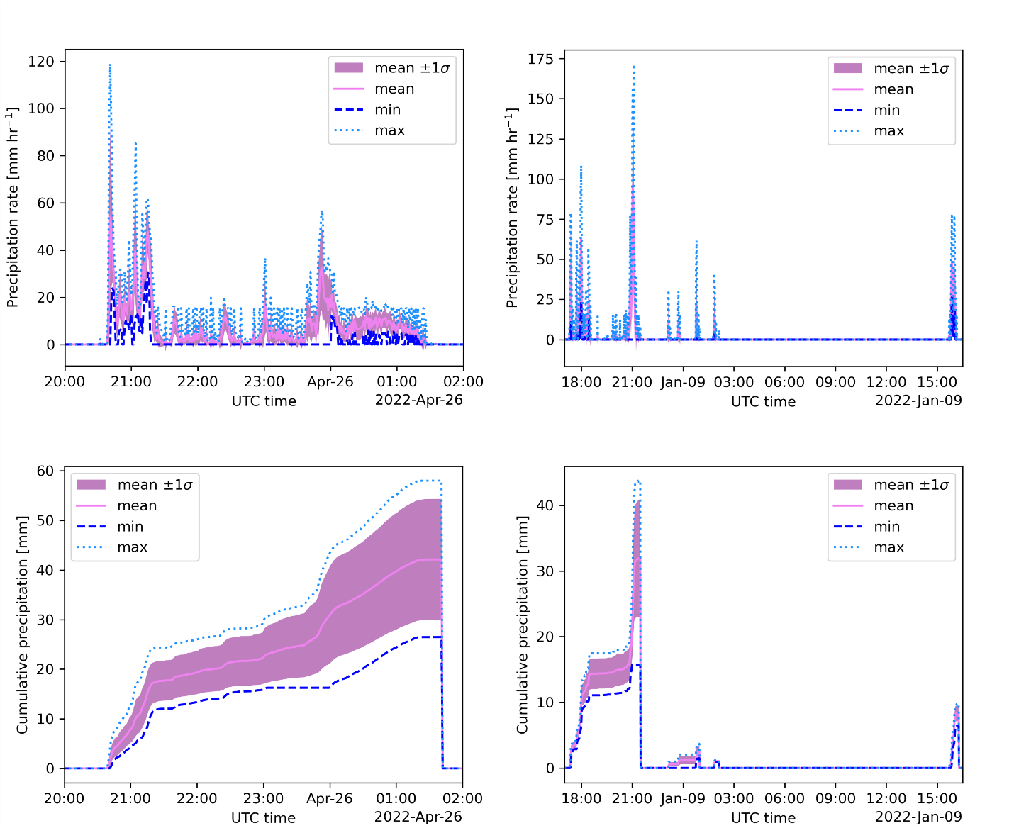
- The precipbetseries product provides time-series data on the minimum, maximum, mean, and standard deviation of per-event cumulative precipitation and precipitation rates at one-minute resolution.
- The precipbestats product includes per-event statistics in an easy-to-use, one-dimensional (tabular) format. Statistics include the minimum, maximum, mean, and standard deviation of precipitation event periods, mean precipitation rates, one-minute maximum precipitation rates, and event total amounts. This datastream also includes ancillary data corresponding to each precipitation event, such as event mean, minimum, maximum, and standard deviation of temperature; relative humidity; and a selected set of drop size distribution moments derived from ARM’s Laser and Video Disdrometer Quantities VAPs (where available). Because this datastream generates files only for days with precipitation, the precipbestats data sets have slightly shorter date ranges than the precipbetseries data.
A Jupyter Notebook demonstrating use of the PrecipBE VAP is available on the ARM-Notebooks GitHub repository.
Initial PrecipBE evaluation data are now available for:
- ARM’s Southern Great Plains (SGP) Central Facility near Lamont, Oklahoma, from July 1993, about 14 months after the site began official operations, to March 2025
- the main site of ARM’s Bankhead National Forest (BNF) atmospheric observatory in Alabama from October 2024, when BNF operations officially began, to March 2025
- the 2021–2022 TRacking Aerosol Convection interactions ExpeRiment (TRACER) at the main ARM Mobile Facility site in La Porte, Texas, and supplemental site S3 in Guy, Texas. The S3 data cover an intensive operational deployment from May through September 2022, while the data from the main site cover campaign operations from October 2021 through September 2022.
The TRACER data are c1-level because the precipitation input data were validated and characterized for data quality issues. The BNF and SGP data are c0-level because they have not yet been fully evaluated for possible instrument issues not captured in existing ARM Data Quality Reports that could influence the PrecipBE quantities in the BNF and newer SGP data. Further evaluation of the BNF and SGP data is ongoing; scientists are encouraged to contact ARM if they notice any issues in these data.
More information about PrecipBE is available on the VAP web page.
Access the data in the ARM Data Center. (To download the data, first create an ARM account.)
For questions or to report data issues before the VAP moves to production, please contact Israel Silber.
The precipbetseries data can be referenced as doi:10.5439/2523643 (c0-level) and 10.5439/2523642 (c1-level). The precipbestats data can be referenced as doi:10.5439/2523641 (c0-level) and 10.5439/2523640 (c1-level).
Follow Us:


Keep up with the Atmospheric Observer
Updates on ARM news, events, and opportunities delivered to your inbox
ARM User Profile
ARM welcomes users from all institutions and nations. A free ARM user account is needed to access ARM data.


