

Power Your Research with ARM
The U.S. Department of Energy’s Atmospheric Radiation Measurement (ARM) User Facility provides 30-plus years of atmospheric measurements, including data sets from all seven continents and five oceans, to advance the understanding of the Earth’s atmosphere.
Access ARM Data
ARM collects continuous measurements and develops data products that promote the advancement of earth system models.
New to ARM?
As a U.S. Department of Energy Office of Science user facility, ARM makes its data freely available to scientists around the world.
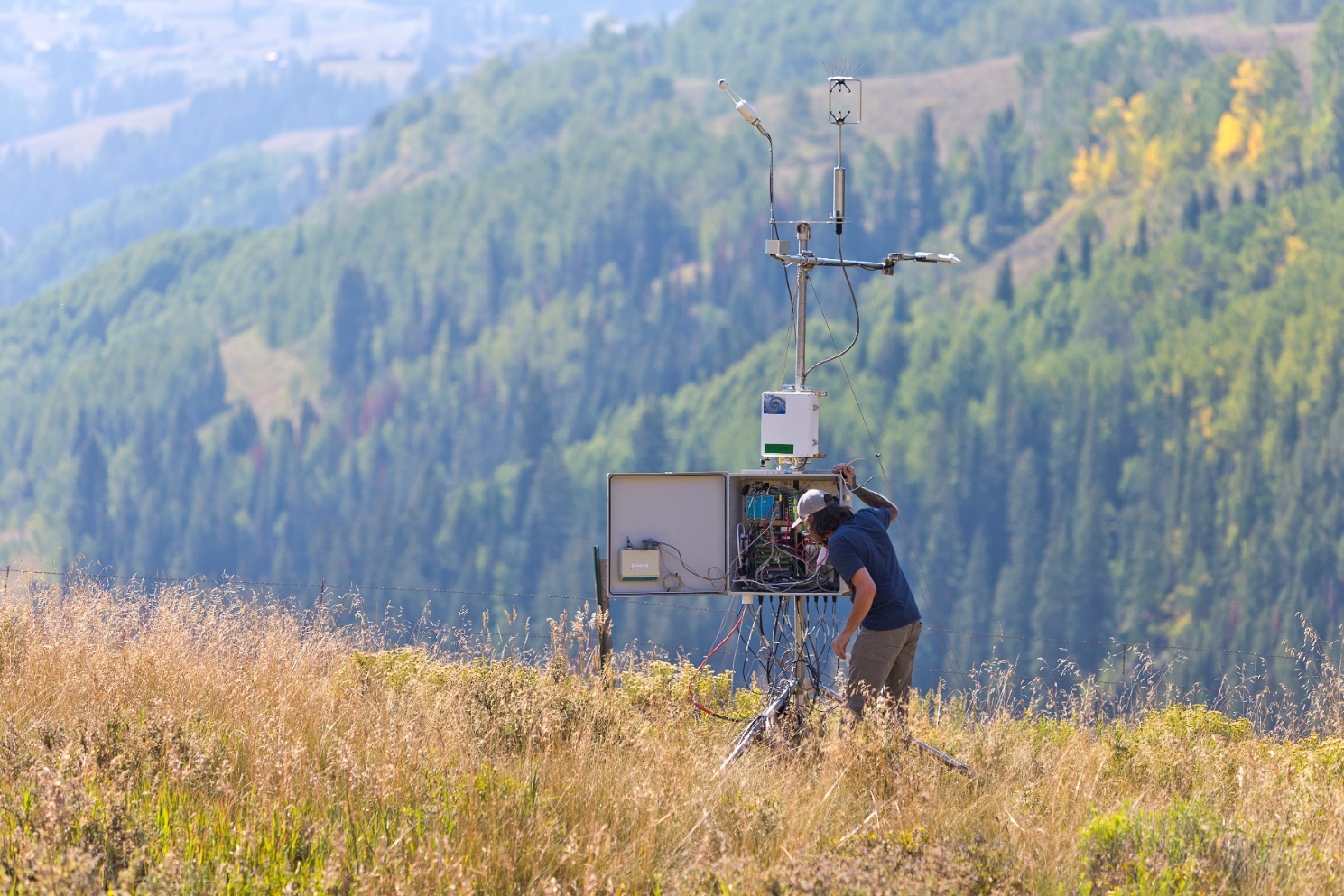
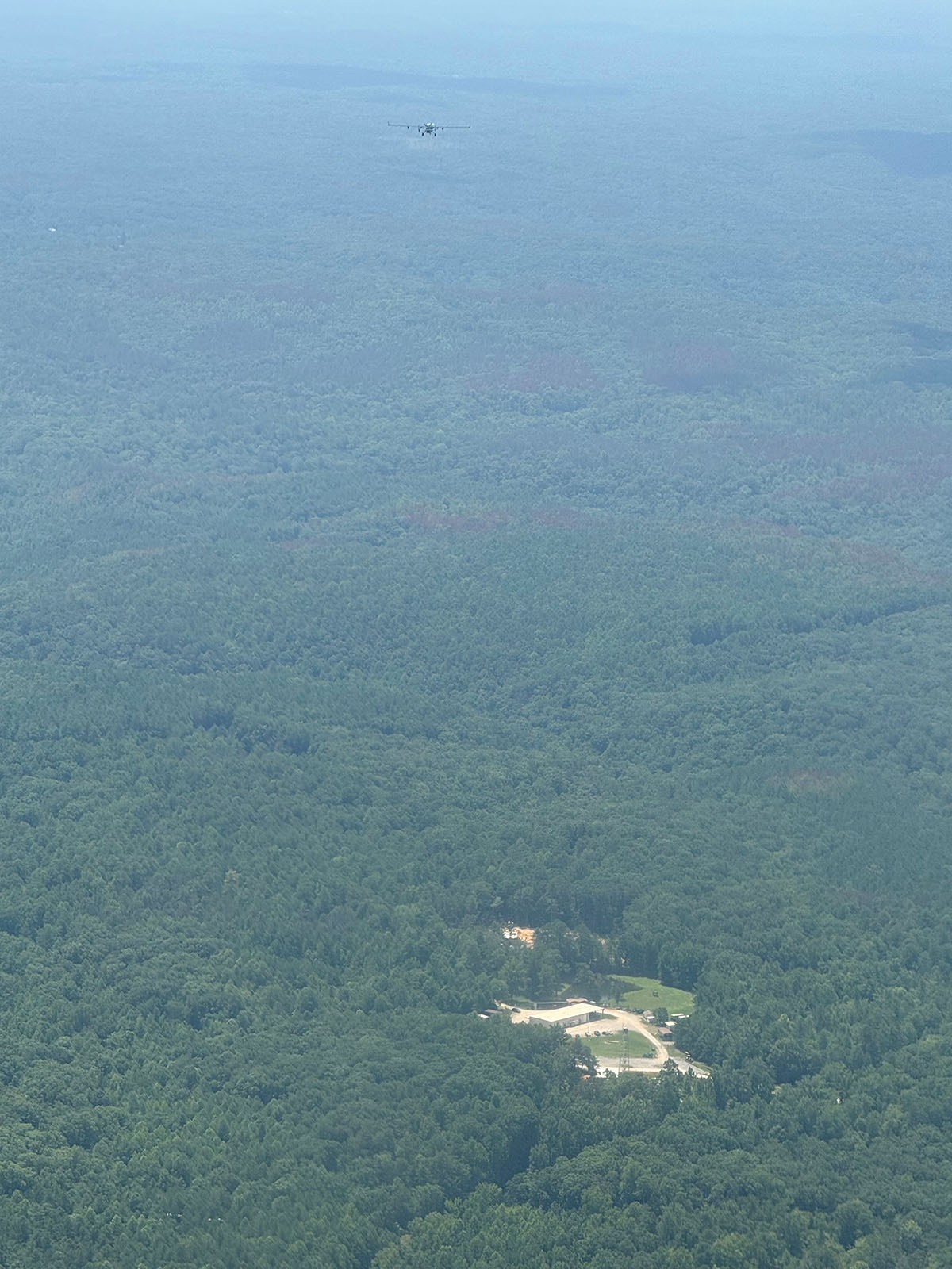
Use ARM Facilities for Your Research
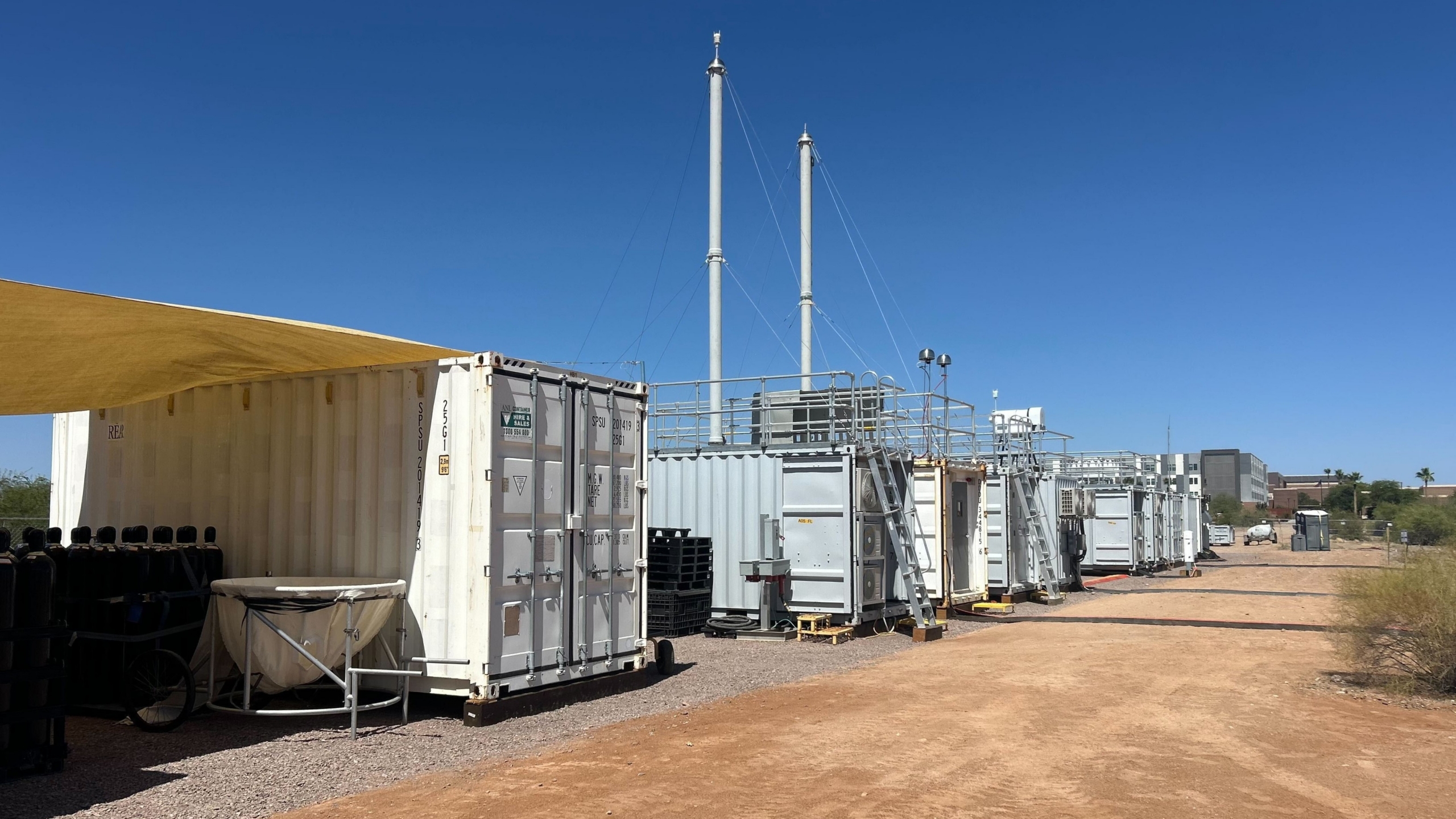
Desert-Urban SysTem IntegratEd AtmospherIc Monsoon
1 June 2026 - 30 September 2027 View All CampaignsARM Annual Facility Call and ARM/EMSL FICUS Call
Deadline has passed View Call InformationExplore the ARM Observatories
Discover ARM's Capabilities

Read the Latest from ARM

Features
ARM Director Winds Down Impactful Career
Jim Mather, who is retiring this summer after three decades with ARM, reflects on his life and career.
ARM Names New Director
Atmospheric scientist Larry Berg will guide ARM into the next era of scientific observations and succeed Jim Mather, who has led ARM since 2007.
Streamlining ARM Data Access With AI-Ready Infrastructure
New storage, software, and computing frameworks set the stage for next-generation data tools and research support.
Data Announcements
New EPCAPE VARANAL Forcing Data Released to Evaluation
A new version of continuous large-scale forcing data for the 2023–2024 Eastern Pacific Cloud Aerosol Precipitation Experiment (EPCAPE) is now available from ARM.
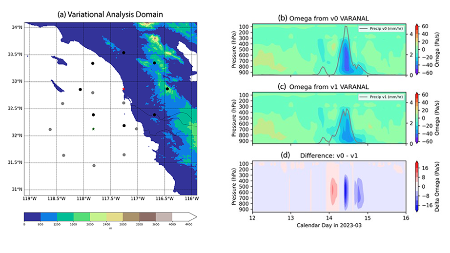
New Southern Great Plains Continuous Large-Scale Forcing Data Released
This constrained variational analysis (VARANAL) value-added product includes both the large-scale forcing terms and the evaluation fields, which can be used for driving a variety of models and validating simulations.
ARM Releases New Cloud Optical Depth Product
ARM has developed the Three-Channel Sunphotometer Cloud Mode (SPHOTCOD) value-added product to provide information on cloud properties for process studies.
Research Highlights
Turbulence Controls on Marine Shallow Cumulus Cloudiness
Marine shallow cumulus clouds cool the Earth by reflecting solar radiation back to space and are challenging to accurately represent in earth system models. These clouds are intimately coupled with turbulence in the boundary layer. Here, vertical air motion and its co-variability with cumulus cloudiness are characterized using data from the Atmospheric Radiation Measurement (ARM) Eastern North Atlantic (ENA) observatory.
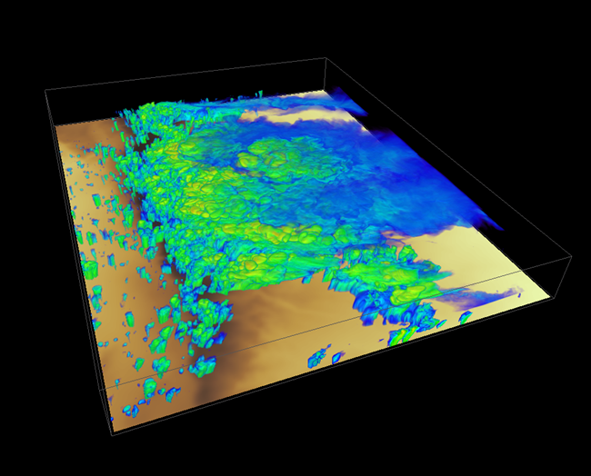
Generating a Stratocumulus-Like Cloud Top in a Convection-Cloud Chamber
Stratocumulus clouds cover a large fraction of Earth’s surface and strongly influence regional weather and the global energy balance. Entrainment, the mixing process at the top of the stratocumulus-topped boundary layer, strongly influences cloud lifetime, precipitation, and radiative properties. Despite its importance, entrainment remains poorly understood, largely due to the difficulty in observing fine-scale structures near the cloud top, which can be only meters thick. We therefore propose a laboratory facility with controllable conditions and the use of numerical simulations to demonstrate how cloud-top entrainment can be studied experimentally.
A Concept of a Convection-Cloud Chamber to Study Aerosol-Cloud-Drizzle Interactions
The Aerosol-Cloud-Drizzle Convection Chamber (ACDC2) collaboration has developed a comprehensive concept and modeling hierarchy for a convection-cloud chamber facility designed to investigate the chain of events from aerosol activation to cloud droplet growth and drizzle formation within turbulent clouds. The proposed 9-meter-tall chamber enables steady-state turbulence and microphysical conditions, facilitating continuous direct observation of cloud and aerosol properties.
Follow Us:


Keep up with the Atmospheric Observer
Updates on ARM news, events, and opportunities delivered to your inbox
ARM User Profile
ARM welcomes users from all institutions and nations. A free ARM user account is needed to access ARM data.


