An official website of the United States government





New Microwave Radiometer Retrieval Data Released
Published: 3 August 2026
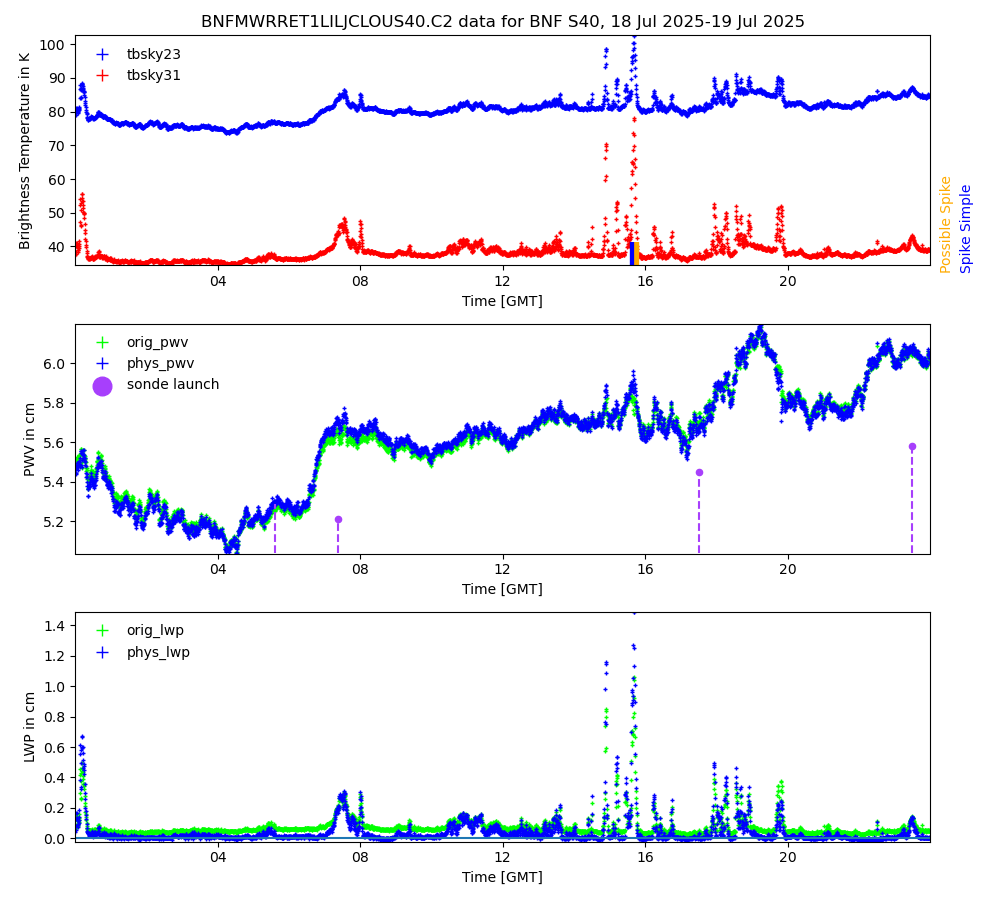
The Microwave Radiometer Retrievals value-added product (MWRRET VAP) is now available for the Bankhead National Forest (BNF) atmospheric observatory in northwestern Alabama; the 2024–2025 Coast-Urban-Rural Atmospheric Gradient Experiment (CoURAGE) in the Baltimore, Maryland, area; and the 2024–2025 Cloud And Precipitation Experiment at kennaook (CAPE-k) in northwestern Tasmania. In addition, new MWRRET data are available for the Atmospheric Radiation Measurement (ARM) User Facility’s North Slope of Alaska (NSA) observatory for the years 2024 and 2025.
MWRRET retrieves column precipitable water vapor and liquid water path—both important variables to understanding radiative transfer in the atmosphere and clouds—from ARM’s 2-channel microwave radiometers (23.8 and 31.4 GHz). The VAP uses a physical retrieval methodology that provides improved retrievals over the standard statistical coefficient method.
The MWRRET data are available as .c2-level files. During c2 processing, improved offsets are applied to the 23.8 GHz channel, improving the precipitable water vapor retrievals. In addition, this stage uses cloud vertical extent information from the Active Remote Sensing of CLouds (ARSCL) VAP rather than ceilometer data to get the correct temperature of the liquid water layers in the atmosphere.
More information about MWRRET, including the technical report, can be found on the VAP web page.
CAPE-k data for the ARM Mobile Facility site and CoURAGE data for the supplemental site on Kent Island within the Chesapeake Bay are available for the full length of each campaign. BNF data are available for the Double Springs supplemental site from January 6 through December 31, 2025, and NSA data are available for the central facility at Utqiaġvik (formerly Barrow) from January 1, 2024, through December 31, 2025.
Access the MWRRET data now in the ARM Data Center. (To download the data, first create an ARM account.)
Feedback on the VAP can be sent to ARM translator Damao Zhang.
To cite the MWRRET data, please use doi:10.5439/1027369.

Follow Us:






Keep up with the Atmospheric Observer
Updates on ARM news, events, and opportunities delivered to your inbox
ARM User Profile
ARM welcomes users from all institutions and nations. A free ARM user account is needed to access ARM data.