

3-Dimensional Cloud Positions Produced for TRACER Campaign
Published: 22 May 2024
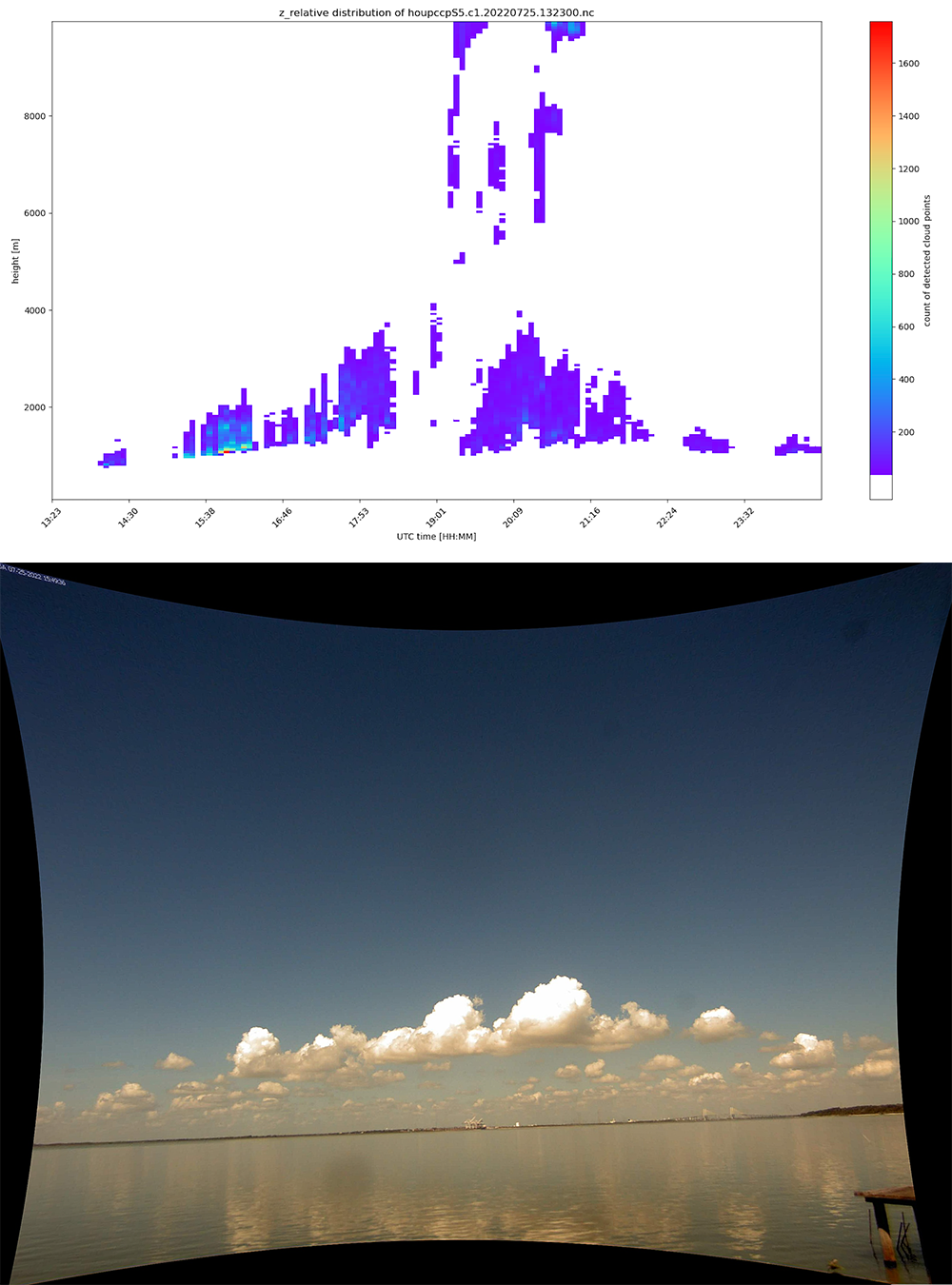
The Point Cloud of Cloud Points value-added product (PCCP VAP) is now available for the 2021–2022 TRacking Aerosol Convection interactions ExpeRiment (TRACER) in the Houston, Texas, area.
PCCP enables three-dimensional (3D) representations related to macrophysical cloud features such as cloud-base and cloud-top heights, structure of cloud boundaries, and cloud-level horizontal velocities. PCCP data are retrieved from images captured by stereo-calibrated camera pairs.
The PCCP TRACER data set consists of 3D coordinates describing the positions of cloud features throughout the campaign and images from which the coordinates were reconstructed.
During TRACER, two ARM cloud digital cameras, which were located in Baytown, Texas, at 29o41’38.1″N, 94o56’11.87″W and 29o41’1.1″N, 94o56’8.13″W, captured images in the daytime at 20-second intervals. The 3D PCCP coordinates were detected with respect to the ARM Mobile Facility location in La Porte, Texas, at 29o40’11.36″N, 95o3’34.80″W.
More information about PCCP can be found on the VAP web page. A Python script that plots instantaneous PCCP data is also available.
Access the data in the ARM Data Center. (To download the data, first create an ARM account.)
For questions or to report data problems, please contact Rusen Öktem or David Romps.
To cite the data, please use doi:10.5439/1531325.
Follow Us:


Keep up with the Atmospheric Observer
Updates on ARM news, events, and opportunities delivered to your inbox
ARM User Profile
ARM welcomes users from all institutions and nations. A free ARM user account is needed to access ARM data.


