

ARM to Launch Lidar Intercomparison at Southern Great Plains Observatory
Published: 21 November 2025
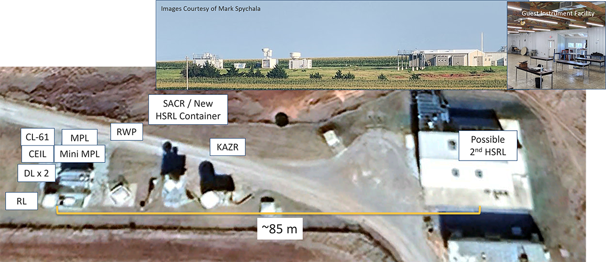
The U.S. Department of Energy’s Atmospheric Radiation Measurement (ARM) User Facility is preparing to host a lidar intercomparison campaign at its Southern Great Plains atmospheric observatory in Oklahoma. This effort aims to evaluate and benchmark the performance of different ARM lidars under a range of atmospheric conditions. ARM welcomes participation from principal investigators interested in contributing guest instruments to this intercomparison.
Across its fixed-location and mobile facilities, ARM operates a wide variety of lidars, including ceilometers, micropulse lidars, Doppler lidars, Raman lidars, and high-spectral-resolution lidars. The intercomparison will also feature new systems, such as a polarization-enabled ceilometer and an ultra-high-definition mini micropulse lidar.
With this growing and evolving inventory of lidar technologies, ARM’s goal is to ensure that its network of instruments remains robust, well-characterized, and scalable to support a broad range of existing and emerging atmospheric science needs. Scheduled to start in December 2025, depending on instrument delivery and weather conditions, the intercomparison will focus on assessing measurement consistency, calibration stability, and operational performance across systems to inform ARM’s lidar strategy.
Scientists and organizations with lidar or complementary atmospheric sensing systems are encouraged to propose participation through the standard ARM field campaign process. Guest contributions will strengthen intercomparisons and help advance community understanding of lidar performance and harmonization.
ARM will provide space, power, internet, and site operations support for approved guest instruments participating in this intercomparison, but it will not provide support for shipping.
Follow Us:


Keep up with the Atmospheric Observer
Updates on ARM news, events, and opportunities delivered to your inbox
ARM User Profile
ARM welcomes users from all institutions and nations. A free ARM user account is needed to access ARM data.


