

Capturing Coastal Cloud Complexity
Published: 28 May 2026
EPCAPE campaign delivers data to refine earth system models
More than two years after the Eastern Pacific Cloud Aerosol Precipitation Experiment (EPCAPE) concluded in La Jolla, California, researchers are analyzing its detailed observational records of coastal marine clouds.
The U.S. Department of Energy’s (DOE’s) Atmospheric Radiation Measurement (ARM) User Facility field campaign concluded 12 months of continuous EPCAPE measurements in February 2024.
Low-lying marine clouds are common along coastlines worldwide, yet their properties and processes remain difficult to accurately represent in earth system models (ESMs). Long-term observational data sets are limited, contributing to persistent uncertainties in models.
EPCAPE sought to fill data gaps on coastal marine clouds and aerosols. Aerosols are tiny particles essential to cloud formation and precipitation. Aerosols also influence how clouds interact with the sun’s radiative energy.
The central objective of EPCAPE was to improve understanding of how aerosols and clouds interact—identifying where models succeed or fall short, how model performance varies by season, and how aerosol composition, concentration, and origin influence cloud behavior.
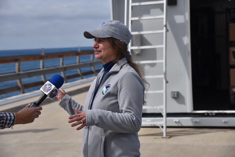
Set in a region famous for its cloud transitions, the EPCAPE campaign “gave us an amazing data set for cloud conditions,” says EPCAPE Principal Investigator Lynn Russell, a professor at Scripps Institution of Oceanography at the University of California San Diego (UCSD).
Data Availability
Most of EPCAPE’s data came from ARM instruments. The campaign generated more than 200 data products, including ARM value-added products (VAPs) and guest instrument measurements.
ARM staff members analyze and process VAPs to make ARM data easier to use in atmospheric research and ESMs. Popular EPCAPE VAPs include:
- Ka-Band ARM Zenith Radar (KAZR) Active Remote Sensing of CLouds (KAZRARSCL)
- Continuous large-scale forcing data developed from a constrained variational analysis approach (VARANAL)
- Planetary Boundary Layer Height (PBLHT).
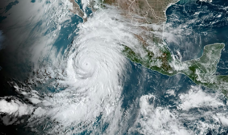
Israel Silber, an EPCAPE co-investigator and earth scientist at Pacific Northwest National Laboratory in Washington state, led the development of an ARM data epoch that captured atmospheric conditions associated with Tropical Storm Hilary in August 2023.
Data epochs consist of measurements from at least one location, with well-characterized data quality and corrections and calibrations applied, over a specified time range of scientific interest.
Hilary enabled ARM’s sensors to record a locally historic transition from clear skies to deep, precipitating cloud decks.
The Hilary epoch and other EPCAPE data from ARM and guest instruments are available to the research community through the ARM Data Center.
ARM supported 16 guest field campaigns related to EPCAPE. Led by scientists from universities and research institutions, these campaigns contributed additional data for investigating marine cloud and aerosol processes.
In addition to the guest measurements in the ARM Data Center, some data from guest instruments are archived at UCSD.
In June 2023, DOE’s Atmospheric System Research (ASR) activity and the Office of Naval Research funded the Southern California Interactions of Low cloud and Land Aerosol (SCILLA) experiment to provide regional context for EPCAPE. Using a Twin Otter research aircraft, SCILLA scientists gathered data on airmasses before they reached EPCAPE’s ground-based sites. SCILLA measurements are available as principal investigator data in the ARM Data Center.
A Layered View of Coastal Conditions
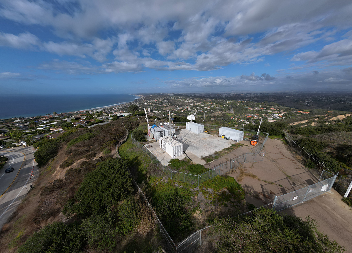
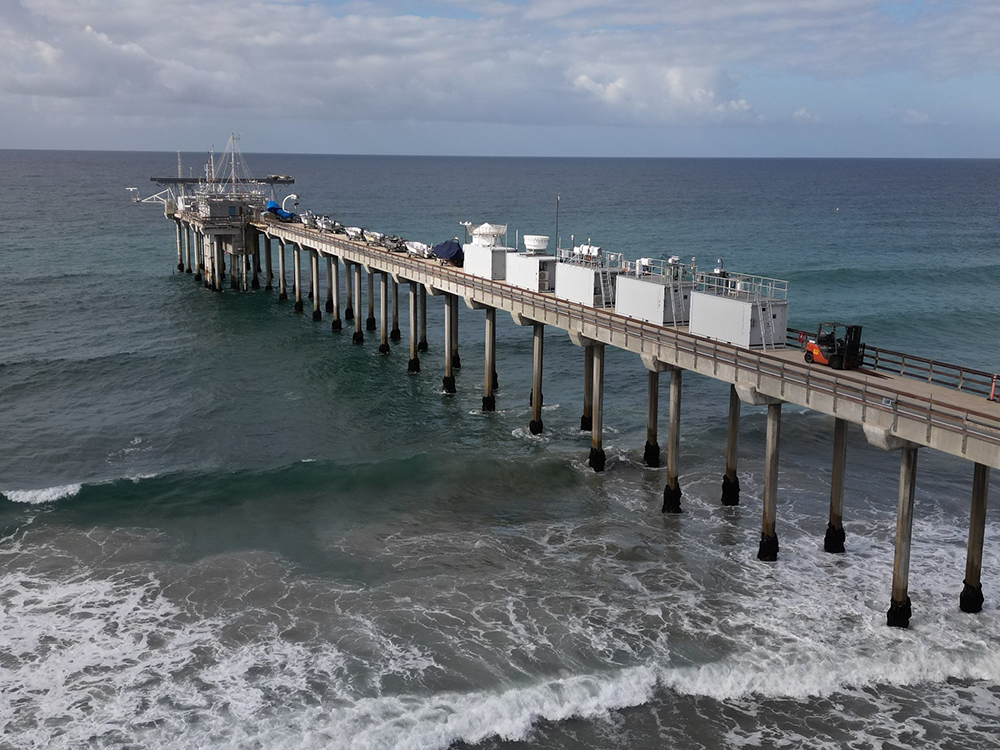
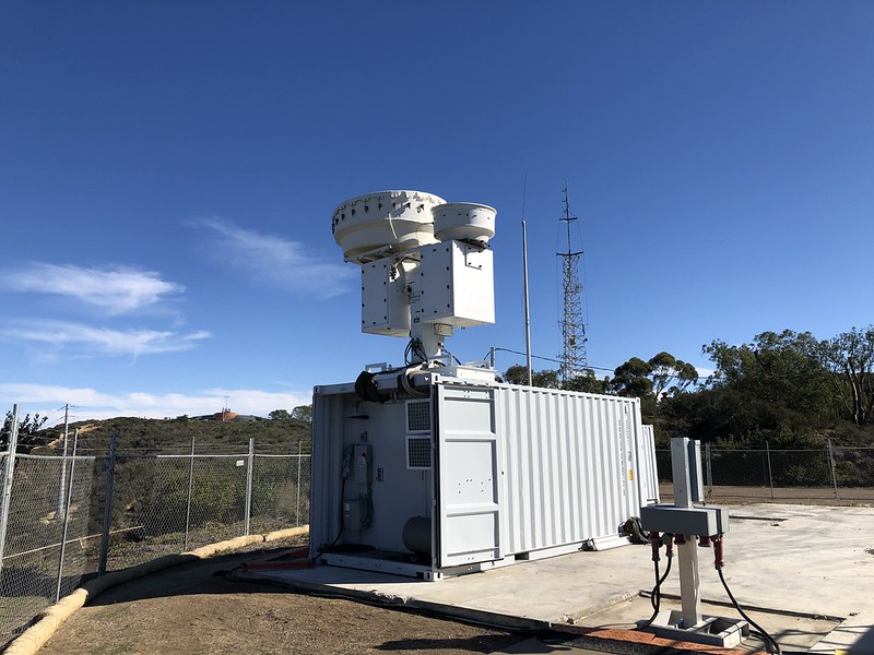
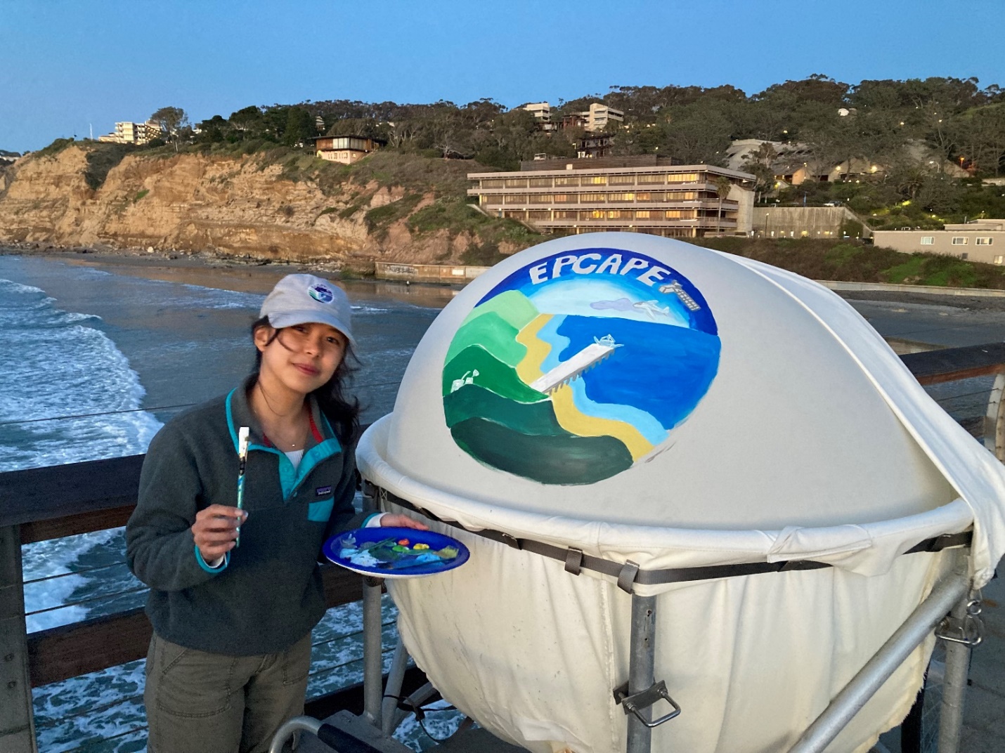
About 50 instruments were deployed at two sites in La Jolla to collect EPCAPE data—one extending over the Pacific Ocean on the Ellen Browning Scripps Memorial Pier and the other positioned high above it on Mount Soledad (elevation 820 feet, or 250 meters).
Instruments installed on the pier included an Aerosol Observing System, an eddy correlation flux measurement system, a KAZR, and a micropulse lidar. Instruments deployed on Mount Soledad included a ceilometer, a Ka-Band Scanning ARM Cloud Radar, a laser disdrometer, and 2- and 3-channel microwave radiometers. See the full list of EPCAPE instruments and browse their data.
Instruments at the mountaintop site produced an unprecedented 800-hour record of in-cloud observations. The campaign also captured valuable data on marine airmasses, offering the research community a rare, vertically layered view of coastal atmospheric processes.
Overall, the data reflect influences from three primary airmass sources: marine air from the west, dust-laden air from agricultural regions to the east, and more complex airmasses from the northwest associated with urban areas such as Los Angeles and Long Beach, California. Northwesterly airmasses dominated about 60% of the time, yielding the largest statistical sample.
The breadth of measurements collected across times of day and seasons is already revealing a wide range of aerosol-cloud interactions typical of coastal environments. The data are also being used to examine how aerosols influence cloud structure and radiative behavior.
Comparative analyses of pier and mountaintop data show that particle sizes and chemical composition are often similar, but differences emerge under certain conditions. These variations are linked to land-sea breeze patterns and to changes in humidity and temperature.
At the same time, particle composition can moderate these effects, offering additional insight into how well models capture these processes.
Cloud processes and mechanisms observed during EPCAPE were consistent across months rather than days. This consistency made it easier for researchers to characterize cloud behavior and provided constraints for better tuning ESMs.
Stratocumulus clouds persisted over La Jolla from about April through October 2023. Investigators are analyzing how this pattern appears in surface radiation records from Scripps Pier and Mount Soledad.
Cloud Physics, Chemistry, and Particle Sampling

EPCAPE data have informed research that is advancing understanding of cloud physics, chemistry, and particle sampling. To date, more than a dozen EPCAPE-related journal articles have been published, exploring topics such as:
- The processes by which aerosol particles become cloud droplets, and the ways clouds can alter particle composition. These interactions involve cloud chemistry, particle shape, and liquid water content, all of which influence how clouds reflect and absorb radiation.
- The link of aerosol characteristics to cloud properties based on simultaneous measurements from Scripps Pier and Mount Soledad.
- How semivolatile organic compounds may play an important role in particle formation and growth, particularly through interactions with liquid water, which can increase particle size within clouds.
Other papers revealed strong coupling between gas- and particle-phase chemistry, with important implications for accurately characterizing aerosol-cloud interactions.
For example, a January 2026 coastal cloud chemistry paper led by Elavarasi Ravichandran, a doctoral student at the University of California, Riverside, showed how gases can dramatically alter how aerosol particles form cloud droplets.
By collecting air from the chemically complex marine cloud layer during EPCAPE and briefly stripping away gases using a charcoal-based scrubber, the research team found that droplet-forming behavior changed as much as it would after days of heat or UV exposure—an impressive effect achieved in just 20 seconds.
The study showed that removing semivolatile gases from ambient aerosols can substantially alter cloud droplet formation by changing the capacity of the particles to attract and take up moisture from the environment, sometimes increasing or decreasing their ability to act as cloud condensation nuclei (CCN).
Validating and Evaluating Instruments
EPCAPE observations have also proven valuable for instrument validation and evaluation. A May 2024 paper used radiosonde data to assess satellite estimates of atmospheric boundary-layer height, a key factor in determining the distribution of aerosols and gases near the surface. An August 2024 paper evaluated the performance of ARM’s shortwave array spectroradiometer-hemispheric, a ground-based radiometer that measures the intensity of radiative energy.
A June 2024 paper documented what are believed to be the first simultaneous ground-based Ka-, W-, and G-band profiles, provided by a NASA Jet Propulsion Laboratory CloudCube radar that operated on the pier during EPCAPE. These profiles created a data set for studying cloud microphysics and light precipitation over the coast.
Another study, published in December 2024, examined combined KAZR and CloudCube G-band data. Together, these instruments improved the accuracy of cloud liquid water profiling during EPCAPE, an important variable for understanding cloud structure and precipitation potential.
A November 2025 paper evaluated Doppler lidar retrievals of sea spray aerosol production fluxes against in situ ARM measurements, identifying strengths, uncertainties, and boundary-layer constraints that affect the agreement between the data and support lidar-based aerosol flux estimates in coastal environments.
Insights From Back Trajectory Modeling
Silber led a January 2025 paper focused on reconstructing the history of airmasses reaching the EPCAPE sites. The paper introduced an airmass reanalysis tool based on back trajectory modeling.
Back trajectories estimate the prior pathways and environmental histories of air parcels reaching the measurement site. They help researchers understand the evolution of cloud and aerosol processes and provide a way to categorize data. These estimates enable cloud formation studies by identifying likely sources of aerosols upwind (in the past).
The back trajectory data sets in Silber’s paper support four categories of atmospheric research:
- the surface (ocean and land)
- the planetary boundary layer, which is the region of mixed air closest to the Earth’s surface
- liquid (supersaturated, droplet-containing) cloud layers
- entire cloud decks.
Because fixed, ground-based instruments provide data from a single location, they offer a limited historical perspective. Back trajectory methods add a complementary view by tracing atmospheric processes backward in time, incorporating a dynamic, system-following perspective.
This combined approach helps address model uncertainties, particularly those related to processes occurring at different spatial and temporal scales.
The back trajectory data sets in Silber’s paper are available as part of the multipurpose ARM trajectory (ARMTRAJ) VAP.
Nattamon Maneenoi, who received her master’s degree from Scripps after EPCAPE, led a March 2025 paper that used the back trajectory data to examine sulfate formation influenced by cloud processes upwind of the EPCAPE sites. The study examines the relationship between cloud-processed particle properties and upwind cloud vertical fraction, enabled by simultaneous measurements of local cloud fraction and upwind properties from the ARMTRAJ VAP and ARM-funded NASA Langley Research Center Satellite ClOud and Radiation Property retrieval System (SatCORPS) products. It showed how this relationship is useful for quantifying aqueous reactions in clouds, and other cloud-related processes are currently under investigation.
Extending the Science Through Earth System Modeling

EPCAPE data are now supporting efforts to evaluate and improve ESMs.
Yunyan Zhang and Peter Bogenschutz, atmospheric scientists and modelers at Lawrence Livermore National Laboratory in California, created three EPCAPE cases that are now included in DOE’s Energy Exascale Earth System Model (E3SM) case library. The effort is supported by Tying in High Resolution E3SM with ARM Data (THREAD), an ASR Science Focus Area project. The THREAD team is preparing a paper that evaluates the Simple Cloud-Resolving E3SM Atmosphere Model (SCREAM) against EPCAPE observations.
In another modeling spinoff from the campaign, Russell is working with two EPCAPE co-investigators, Rutgers University professor Mark Miller and Scripps researcher Dan Lubin, on a new project that will link in-cloud turbulence and physical cloud features to supersaturation.
Under these conditions, so much water vapor is in the air that some of it condenses into cloud droplets. Supersaturation also influences the size and number of cloud droplets. The researchers are asking: Which particles activate to become CCN? And what quantifiable changes in the aerosols come from cloud properties like supersaturation?
Untapped Data, Open Questions, and DUSTIEAIM
Looking ahead to what’s next for EPCAPE data, Russell points to two areas: turbulent interactions with clouds and a fuller accounting of surface radiation and fluxes.
She adds that researchers are learning more about CCN, including the role of semivolatile species. Multi‑month measurements showed periods when additional water in CCN instruments shifted gases into particles, revealing conditions when the effect is large and when it is absent.
The EPCAPE science team is preparing a campaign overview paper focusing on the behavior of atmospheric particles. The team’s paper is expected to be published later in 2026. Early conclusions focus on chemical composition and variability, methods for measuring how substances transition between phases, and tracking chemical changes.
Russell, who is part of the research team for ARM’s upcoming Desert-Urban SysTem IntegratEd AtmospherIc Monsoon (DUSTIEAIM) campaign in Arizona, says that experiences from EPCAPE motivated a focus on the size distribution of aerosols at DUSTIEAIM. In fact, this focus led to a proposal to add instruments capable of targeting the composition of larger particles during DUSTIEAIM.
“The goal is to innovate measurement methods to capture differences expected in a dust‑influenced setting, complementing what EPCAPE revealed on the California coast,” she says.
Russell expects multiple EPCAPE abstract submissions to the October 2026 American Association for Aerosol Research Annual Conference, December 2026 American Geophysical Union Annual Meeting, and January 2027 American Meteorological Society Annual Meeting.
From Coastal Detail to Global Insight
As analyses continue, EPCAPE is emerging as more than a regional study. It is a proving ground for how sustained, high-resolution observations can close long-standing gaps between atmospheric complexity and model representation.
By sampling aerosol-cloud interactions across seasons, elevations, and airmass histories, the campaign offers benchmark data against which next-generation models can be tested and refined.
The growing body of research based on EPCAPE data underscores a central lesson for atmospheric science, according to Russell: “Resolving uncertainty in cloud behavior will depend not on isolated case studies, but on integrated, continuous observations that connect processes across time scales.”
Follow Us:


Keep up with the Atmospheric Observer
Updates on ARM news, events, and opportunities delivered to your inbox
ARM User Profile
ARM welcomes users from all institutions and nations. A free ARM user account is needed to access ARM data.


