An official website of the United States government





ARM Conducts Phoenix Study to Unlock Secrets of Monsoon Storms
Published: 30 July 2026
Campaign hosted by Arizona State University will explore how extreme heat, urban growth, and dust influence storm intensity
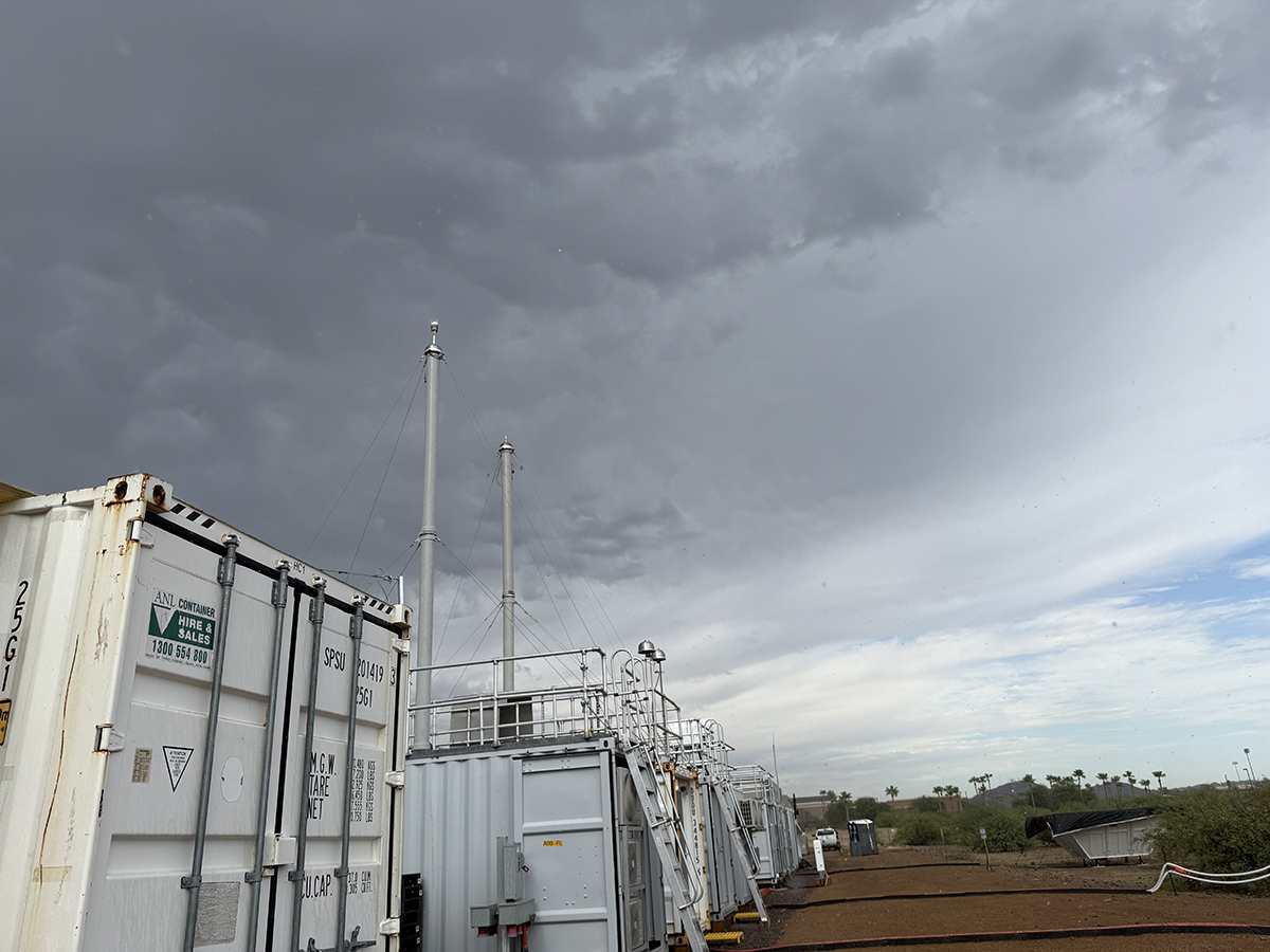
In June 2026, one of the most comprehensive severe weather studies ever conducted in the Phoenix, Arizona, metropolitan area kicked off on ASU’s West Valley campus.
The Desert-Urban SysTem IntegratEd AtmospherIc Monsoon (DUSTIEAIM) field campaign, which began June 1, is a major effort to analyze how severe weather begins and intensifies over one of the hottest urban regions in the United States. The campaign’s lead scientist is Allison C. Aiken, a staff scientist at Los Alamos National Laboratory in New Mexico.
DUSTIEAIM will engage scientists from across the country, as well as ASU faculty and students, to better understand how Phoenix’s heat, urban growth, dust, and desert environment affect storms, rainfall, and the water cycle—especially in relation to the summer monsoon season.
The monsoon season brings severe storms that can sweep through the Phoenix metro area like wrecking balls, taking trees, roads, and roofs with them. Damage can range from downed tree limbs and power outages to destroyed vehicles and homes and widespread neighborhood disruption.
The U.S. Department of Energy’s Atmospheric Radiation Measurement (ARM) User Facility plans to conduct the DUSTIEAIM campaign through September 2027. Data from the campaign are available in the ARM Data Center.
The observations and high-quality data collected through DUSTIEAIM could help improve weather forecasting, guide future infrastructure planning, and provide policymakers with better information about heat, water, and growth.
Ambition in Action
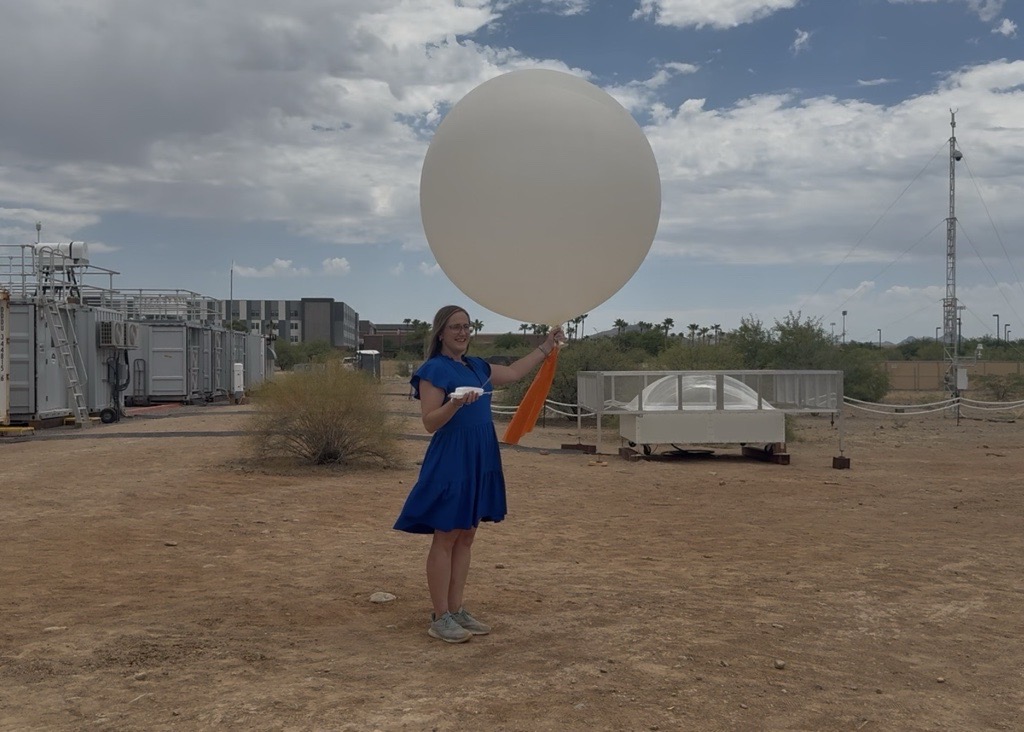
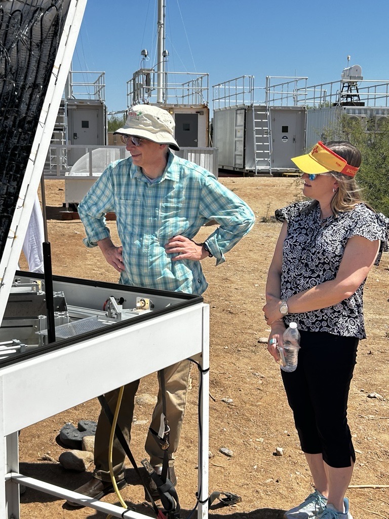
Aiken saw DUSTIEAIM in action during a late June site visit, where she talked with ARM leaders, site technicians, instrument operators, and local journalists who came to report on the campaign. Highlights of her visit included going inside a radar dome that was being set up and participating in two radiosonde launches.
Several times a day, ARM launches radiosondes attached to weather balloons to measure atmospheric temperature, humidity, pressure, and wind speed and direction.
“It was really great to get out to the site in June,” says Aiken, who has been an investigator on previous ARM campaigns. “As always, ARM’s running a very professional site. Everything was well orchestrated.”
Aiken also met with DUSTIEAIM co-investigator Vernon Morris, associate dean for knowledge enterprise and strategic outcomes in ASU’s New College of Interdisciplinary Arts and Sciences.
“This is an ambitious project in both scale and scope,” says Morris. “Urban desert environments like Phoenix are incredibly complex. You have extreme heat, rapid development, and monsoon systems interacting in ways we don’t yet fully understand. This project allows us to study those interactions in real time.”
What Are Researchers Studying?
At its core, DUSTIEAIM seeks to answer three major questions.
First, researchers want to understand how Phoenix itself influences weather. They will examine how buildings, roads, pavement, and urban growth interact with the surrounding Sonoran Desert to affect heat, wind patterns, cloud formation, and storm development.
Second, scientists will investigate the role of dust, wildfire smoke, and other types of aerosol particles in weather systems. Researchers hope to determine how airborne particles affect cloud formation, rainfall, and temperatures, and whether current earth system models accurately capture those effects.
“The single most important question is how do aerosols (mostly dust) affect the formation and development of convective storms, particularly as manifested in the North American Monsoon,” says Jim Mather, who retired as ARM director at the end of July.
Finally, the team wants to understand what factors control where and when rain falls across the Valley of the Sun. They will study how mountains, land surfaces, dust, and broader weather patterns work together to influence rainfall, flash flooding, and storm intensity.
Intensive Operations
The study includes a set of intensive operational periods (IOPs). The first IOP is concentrating on the North American Monsoon season from July through September, including dust storms, flash flooding, and extreme heat. During the current IOP, radiosonde launches have increased from two to six times per day for forecasted events.
“We have done some additional launches based on the extreme heat while we wait for the monsoon storms to arrive,” says Aiken. Through the first 15 days of July, the National Weather Service reported an average high temperature of 108.5 F in Phoenix.
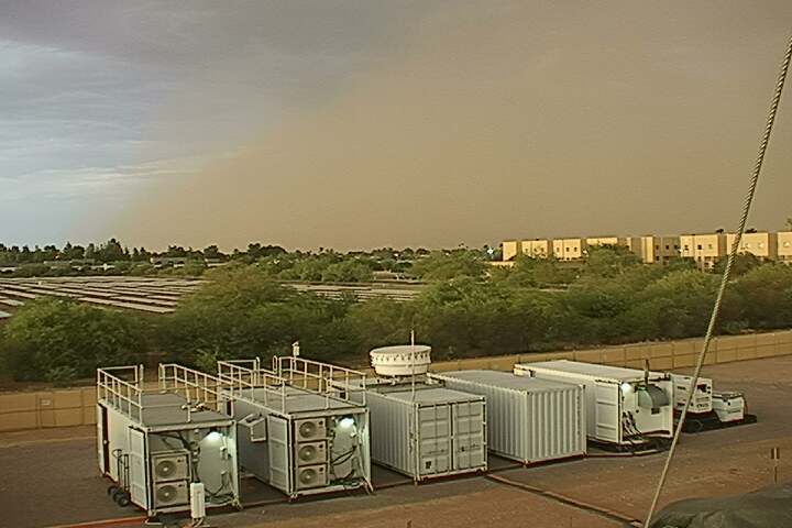
When reviewing early IOP data, Aiken noted aerosol spikes from Fourth of July fireworks. Data got even more exciting on the evenings of July 12 and 13, when intense dust storms known as haboobs rolled through the Phoenix area.
The DUSTIEAIM instruments fared well and recorded data on atmospheric conditions before, during, and after both storms.
“The science team is very excited and is looking into the data we collected during the two dust storms,” says Aiken.
The next IOP is planned from November through March to focus on winter storms and precipitation.
Instruments Running 24/7
Since February, the outskirts of ASU’s West Valley campus have been transformed into sprawling outdoor laboratories filled with meteorological and atmospheric sensors, lasers, radar systems, and weather balloons.
ARM has two 30-foot meteorological towers at the site and up to a dozen tripods at various locations. Specialized laser instruments are measuring particles in the air to help researchers understand how dust interacts with storms.
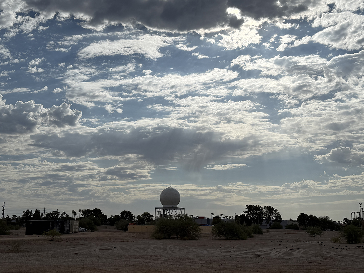
Nearby, a C-band precipitation radar is in place to scan developing storms while other instruments collect data at ground level. The precipitation radar at DUSTIEAIM is new to ARM’s suite of instruments. The ARM radar team is working with scientists to develop the scan strategy for the summer IOP.
In total, roughly 50 ARM instruments are operating around the clock. ARM is also supporting a group of guest research campaigns related to DUSTIEAIM.
After careful review, the U.S. Department of Energy has canceled the planned tethered balloon system operation at the ASU West Valley campus.
A supplemental site is being installed at ASU Polytechnic in Mesa, about an hour’s drive from ASU West Valley, to provide additional land-atmosphere and aerosol measurements for DUSTIEAIM. ARM will have 10 instruments at the ASU Polytechnic site, with the possibility of hosting principal investigator and guest instruments in the future. The instruments will observe storms as they come up from the southeast and move over the main site at ASU West Valley.
Scientists wanting to deploy guest instruments to DUSTIEAIM can still submit small campaign proposals to ARM. Proposals should be submitted at least six weeks before the desired start of the small campaign to allow time for the ARM review process.
Get Involved With DUSTIEAIM
Researchers can access ARM’s DUSTIEAIM campaign dashboard to look at data plots and other information from the field.
Aiken will co-lead a session, “Integrated Studies of Urban Boundary Layer, Air Quality, Cloud and Aerosol Processes,” at the January 2027 American Meteorological Society (AMS) Annual Meeting in Denver, Colorado. AMS is currently accepting session abstracts until August 11, 2026. Abstracts for Aiken’s AMS session can focus on DUSTIEAIM and two past ARM campaigns, the Coast-Urban-Rural Atmospheric Gradient Experiment (CoURAGE) in the Baltimore, Maryland, area and the TRacking Aerosol Convection interactions ExpeRiment (TRACER) around Houston, Texas.
Meanwhile, Aiken is looking for more participants, especially students, to join DUSTIEAIM’s forecasting team. The team is currently using data from NOAA, the National Weather Service, AirNow, the Geostationary Operational Environmental Satellite system, and Pivotal Weather. Aiken seeks input from researchers on additional data sources, forecasting strategies, and information sharing. People interested in providing input or joining the team can contact Aiken.
This article was adapted from Arizona State University.

Follow Us:






Keep up with the Atmospheric Observer
Updates on ARM news, events, and opportunities delivered to your inbox
ARM User Profile
ARM welcomes users from all institutions and nations. A free ARM user account is needed to access ARM data.