An official website of the United States government





Sondes in the Sky Probe Atmospheric Rivers
Published: 28 May 2026
ARM contributes to international campaign exploring high-impact atmospheric phenomena
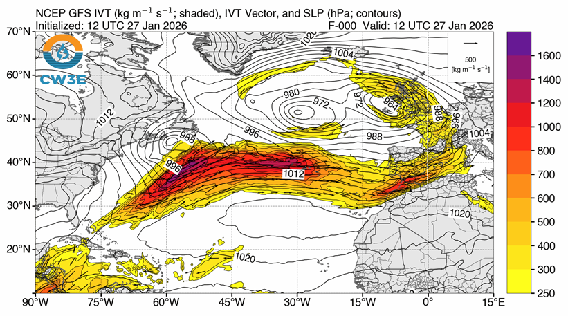
Atmospheric rivers—thin bands of water vapor transport snaking hundreds of miles through the atmosphere—provide needed precipitation to communities worldwide, but sometimes it can be too much of a good thing. As atmospheric rivers move over land, releasing much of their moisture as heavy rain or snow, they can cause widespread flooding, landslides, and power outages.
In general, atmospheric rivers affect midlatitude regions such as the U.S. West Coast and western Europe. Researchers want to understand more about these atmospheric phenomena to improve their representation in earth system models, which help inform energy infrastructure planning. This knowledge will also benefit numerical weather prediction models, which deliver weather forecasts that support disaster preparedness, response, and recovery efforts.
A recent field campaign conducted by the U.S. Department of Energy’s Atmospheric Radiation Measurement (ARM) User Facility provided supplemental data for a larger international campaign studying midlatitude atmospheric dynamics.
The core period of the North Atlantic Waveguide, Dry Intrusion, and Downstream Impact Campaign (NAWDIC) lasted from January 13 to February 20, 2026. Led by Germany’s Karlsruhe Institute of Technology, NAWDIC collected ground-based data in western Europe with aerial measurements obtained by German, French, and U.S. research aircraft flying between the Pacific Ocean and Europe.
NAWDIC project co-leads Julian Quinting of Germany’s University of Cologne and Shira Raveh-Rubin of Israel’s Weizmann Institute of Science oversaw the ARM component of NAWDIC, known as NAWDIC-ARM.
The NAWDIC-ARM campaign ran concurrently with NAWDIC’s core period and took place at ARM’s Eastern North Atlantic (ENA) atmospheric observatory. The ENA is located in the Azores island chain in the eastern Atlantic Ocean.
This was not the first time ARM supported atmospheric river research. In 2015, the ARM Cloud Aerosol Precipitation Experiment (ACAPEX) captured data on four atmospheric rivers that reached Northern California.
Prime Timing and Location
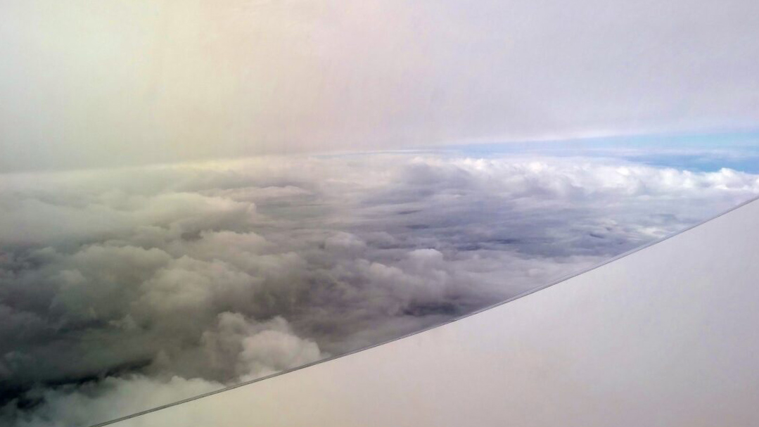
NAWDIC and NAWDIC-ARM researchers set out to learn more about dry intrusions, which serve as a fuel source for high-impact weather systems.
Dry intrusions are air masses that form in the upper troposphere (about 10 kilometers [6.2 miles] above sea level) and gradually descend into the planetary boundary layer, which is the part of the atmosphere that directly interacts with the Earth’s surface. These dry air masses absorb moisture from oceans like large sponges, contributing to the intensification of atmospheric rivers.
Raveh-Rubin and NAWDIC co-investigator Virendra Ghate, who works at Argonne National Laboratory in Illinois, co-wrote a 2021 paper using ENA data to look at the impact of dry intrusions on the marine boundary layer and clouds over the ARM site.
After finding that dry intrusions affected the boundary layer and cloud structure over the ENA about 21% of the time in the winter, the authors suggested that researchers should take dry intrusions into account when studying boundary-layer and cloud processes in the region.
NAWDIC and NAWDIC-ARM proved to be timely.
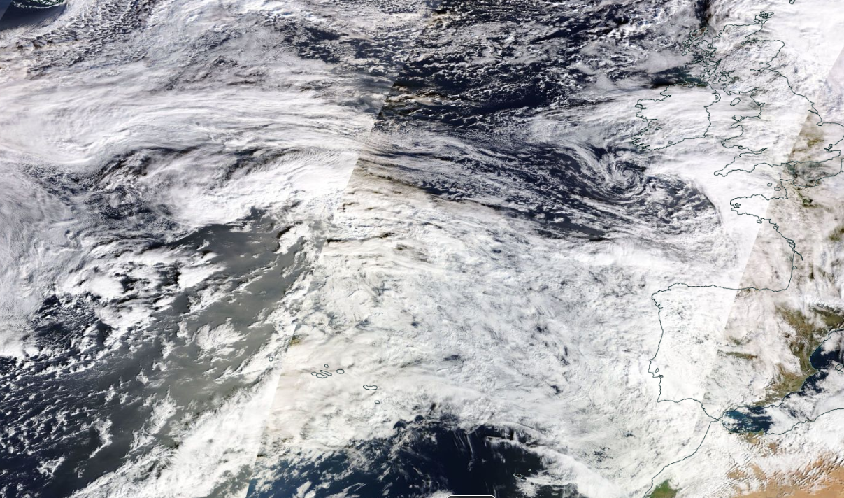
A North Atlantic storm track shifted unusually southward during the campaign. As a result, several atmospheric rivers passed over the Azores on their way to making landfall in western Europe and northern Africa. These regions, as well as the Mediterranean, were hit hard by heavy precipitation, strong winds, floods, landslides, dust storms, and cold temperatures.
Six of the atmospheric rivers stretched over multiple days. The ENA was in a terrific position to collect data on these systems.
The Value of ENA Data
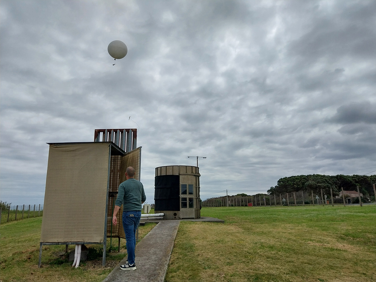
Twice a day as part of routine site operations, the ARM ENA team launches radiosondes attached to large hydrogen-filled balloons. The radiosondes provide vertical profiles of atmospheric pressure, temperature, relative humidity, and wind speed and direction. Ghate and Raveh-Rubin examined ENA radiosonde data in their 2021 paper.
During NAWDIC-ARM’s intensive operational periods (IOPs), the ENA team launched two additional radiosondes each day to capture specific conditions during atmospheric rivers and dry intrusions. The shortest IOP was one day, and the longest IOP was three days.
Overall, ARM launched 32 extra radiosondes over 16 IOPs.
“Given the special weather situation during NAWDIC, we were very happy that radiosondes beyond the original plans were granted by ARM,” says Quinting.
Researchers are now using the radiosonde data to find out how well models represented the moisture transport inside the atmospheric rivers.
Ground-based ENA measurements are also expected to factor into NAWDIC studies.
Researchers plan to use ENA ceilometer and cloud radar data to characterize boundary-layer and cloud properties as the atmospheric rivers passed over the ARM site.
“It is a great asset for the wider NAWDIC community to have access to the diverse array of ARM data,” says Quinting.
ENA radiosonde data and other measurements from the observatory are available in the ARM Data Center.
Author: Katie Dorsey, Staff Writer, Pacific Northwest National Laboratory
# # #ARM is a DOE Office of Science user facility operated by nine DOE national laboratories.

Follow Us:






Keep up with the Atmospheric Observer
Updates on ARM news, events, and opportunities delivered to your inbox
ARM User Profile
ARM welcomes users from all institutions and nations. A free ARM user account is needed to access ARM data.