An official website of the United States government





Pioneers in the Classroom
Published: 30 July 2026
Graduate students complete term projects using ARM data fresh from the field
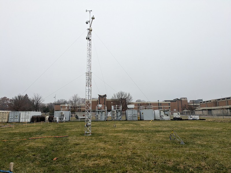
While analyzing new data from the Coast-Urban-Rural Atmospheric Gradient Experiment (CoURAGE), Sandip Pal had an idea for one of his classes at Texas Tech University. Instead of focusing on measurements and publications from much older field campaigns, why not have the students work on the CoURAGE data too?
“Knowledge can be gained in multiple ways,” says Pal, an associate professor of atmospheric science and a member of the CoURAGE science team.
During the spring 2026 semester, graduate students in Pal’s Boundary Layer Meteorology class produced research projects using CoURAGE data and other recent measurements from the U.S. Department of Energy’s Atmospheric Radiation Measurement (ARM) User Facility.
ARM, which deploys and operates fixed-location and mobile atmospheric observatories, conducted the CoURAGE campaign from December 2024 through November 2025 in the Baltimore, Maryland, area. Across multiple sites, instruments collected data to help researchers understand how surface-atmosphere interactions in the Baltimore region affect weather variability within and around the city.
The boundary layer is the part of the atmosphere that is directly influenced by the Earth’s surface. Distinct surface types, including urban landscapes, mountains, flat rural areas, and oceans, can have their own boundary layers, making their transitions hard to model.
ARM CoURAGE data are available for scientists and students to investigate atmospheric processes and properties in the Baltimore area, including boundary-layer features in all four seasons across the campaign’s coastal, urban, and rural sites.
Tying It All Together
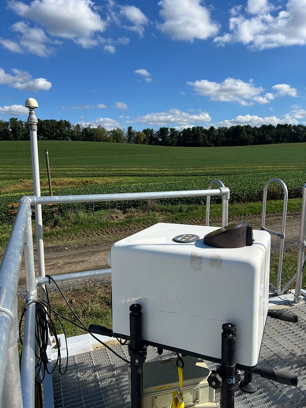
In addition to discussing what the boundary layer is like in each of these environments, Pal’s class looked at what happens when boundary layers move, mix, and change over different environments. To illustrate concepts in his lectures, Pal showed his students a variety of atmospheric data, including measurements from CoURAGE and other ARM sites.
When Pal was a graduate student at the University of Hohenheim in Germany, ARM conducted a 2007 campaign in the country’s Black Forest area. Pal worked on ARM data during the campaign and soon learned the value of using measurements from multiple instruments to uncover boundary-layer processes—a lesson he passed on to his Texas Tech class.
Pal’s students used ARM data and tools for homework assignments, which included developing and using analytical models to simulate scenarios such as boundary-layer growth.
When the time came to pick topics for midterm presentations and final reports, Pal gave the students a list of 30 possible ideas to choose from. They could also modify one of the suggested topics or propose a topic focusing on boundary-layer processes over both land and water and across their interfaces.
Eight of the 16 students selected projects using ARM data. Five of the eight ARM projects focused on CoURAGE observations.
The other ARM projects brought in data from the Bankhead National Forest (BNF) atmospheric observatory, which has operated in Alabama since October 2024; the 2021–2022 TRacking Aerosol Convection interactions ExpeRiment (TRACER) in the Houston, Texas, area; and the April–September 2019 warm season at the Southern Great Plains observatory, which is centered near Lamont, Oklahoma.
Because the CoURAGE and BNF data were so new, students using those measurements had a lack of journal articles to reference from either ARM deployment. Pal met with each student during his office hours to discuss the projects and data sets, helping the students blaze their own research trails.
Real-World Experience
“The coolest thing about that project to me was the fact that I got to slap my name on something that even looked like a real research paper because that’s the first time in my career that I’ve had something like that.”
Gabriel Peña, a graduate student who used ARM CoURAGE field campaign data in a term project at Texas Tech University
Gabriel Peña, who was a first-year graduate student in Pal’s class, has always been interested in severe convective storms and tornadoes. For his project, he decided to characterize nocturnal low-level jets and associated turbulence using CoURAGE lidar data. Low-level jets play a role in increasing the wind shear for tornadoes and supercell thunderstorms.
While some of his classmates downloaded data from the ARM Data Center and used ARM data quality (DQ) tools such as DQ-Zoom Plotter and DQ-Plotbrowser to plot and visualize the measurements, Peña went through ready-made data plots on ARM’s CoURAGE field campaign dashboard. He picked out about 20 potential cases where he saw the presence of a well-defined jet, and Pal helped him cut his list to six cases.
In each of the six cases, Peña characterized the jet based on its maximum wind, core height, depth from top to bottom, start time, peak time, end time, and duration. He also noted the appearance of turbulence in the lidar vertical velocity data. This was indicated by streakiness in the lowest 500 to 1,000 meters (0.31 to 0.62 miles).
Peña was excited about accessing and analyzing real data, using plots that already existed, and writing a report on his work.
“The coolest thing about that project to me was the fact that I got to slap my name on something that even looked like a real research paper because that’s the first time in my career that I’ve had something like that,” he says.
Intriguing Observations
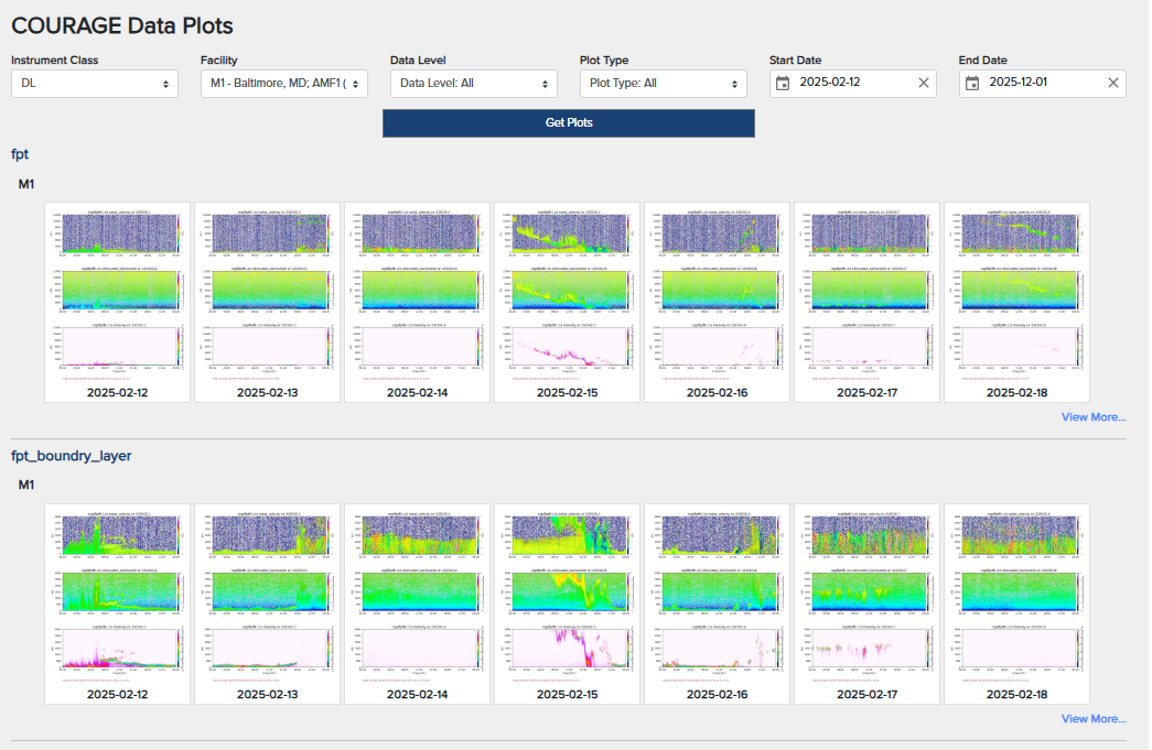
Another student, Ethan Steward, used CoURAGE lidar data in his project. He also worked with radiosonde data to examine differences in nocturnal boundary-layer turbulence across the CoURAGE sites.
Steward, who was a second-year master’s student in atmospheric science when he took Pal’s class, had not used ARM data before. Like Peña, Steward appreciated not having to create data plots from scratch so he could spend more time analyzing and interpreting the data.
The CoURAGE data helped Steward realize how variable atmospheric motion can be across tens of kilometers (about 12 to 60 miles). ARM Doppler lidars at the main site in Baltimore, rural site near Mount Airy, and coastal site on Kent Island within the Chesapeake Bay showed significant differences in turbulence regimes and profiles of vertical wind less than 1 kilometer (0.62 miles) above the ground.
“This spatial variability was something we had briefly talked about in Sandip’s class, but seeing the variance firsthand in the CoURAGE observations was extremely interesting,” says Steward.
Other CoURAGE projects looked at the impact of bay breeze fronts on boundary-layer depth, the variability of atmospheric aerosols and gases across regions in coastal-urban-rural gradients, and the diurnal evolution of wind profiles across those regions.
Tapping BNF Data
Nanditha Subhash might have been the most experienced ARM data user in the class. She had analyzed BNF data for her master’s thesis on how different weather systems can affect carbon dioxide interactions with the land and atmosphere.
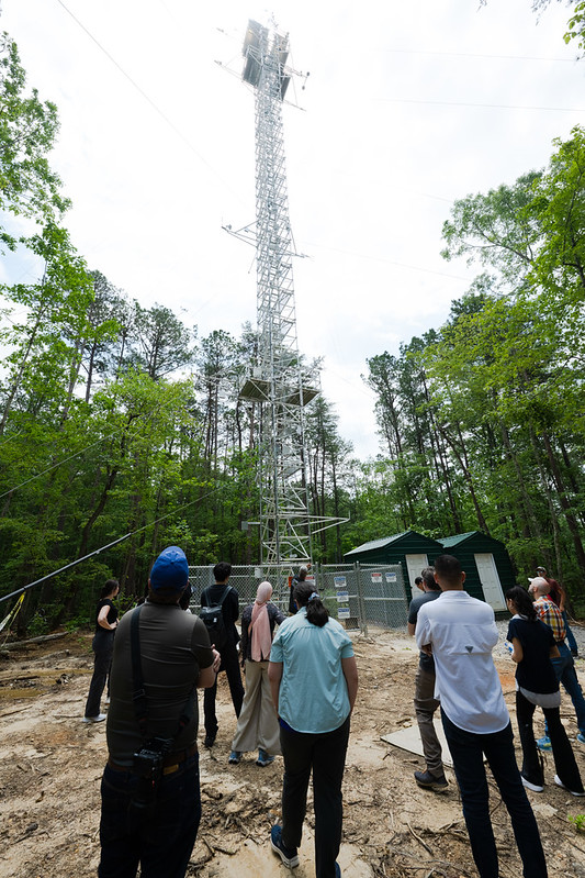
In May 2025, Subhash attended ARM’s Open Science in the Forest Summer School in Huntsville, Alabama. During the weeklong program, students worked in groups to answer science questions using BNF data. Subhash’s group explored land-atmosphere interactions across heterogeneous landscapes in the Southeastern United States. This topic tied in well with her thesis.
The summer school students used ARM-supported open-source tools, primarily the Python ARM Radar Toolkit and Atmospheric data Community Toolkit, to plot and visualize data for their group projects. They also toured the BNF and saw ARM instruments in person, gaining a better understanding of the observatory and the environment around it.
For Pal’s class, Subhash documented how cold front passages changed boundary-layer features at the BNF during the summer. The topic was related to her thesis, which focused on how to see the carbon dioxide flux interaction with cold fronts passing over three BNF sites. She used quality-controlled eddy correlation carbon dioxide flux data, heat flux data, Doppler lidar data, and meteorological measurements for her thesis.
“After the course, I also knew that there is a lot we can do from the same data in the boundary-layer perspective,” says Subhash. “I didn’t have time to incorporate that in my (thesis) research, but this course and the project gave me the opportunity to do that.”
Her project incorporated quality-controlled eddy correlation heat flux data, Doppler lidar data, and meteorological measurements. In her final report, Subhash states that her work “provides the first observational characterization of frontal ABL (atmospheric boundary layer) modification at a humid Southeastern U.S. forest observatory, establishing a new benchmark for this regime.”
What’s Next
Since completing Pal’s class, Subhash successfully defended her thesis. She plans to walk in Texas Tech’s summer graduate commencement ceremony in August 2026 and start a PhD position in the fall at the University of Massachusetts Lowell. She will focus on water vapor flux research driven by the Community Earth System Model.
Steward is now working toward his PhD in geosciences with a concentration in atmospheric science, and Peña is continuing his master’s studies in atmospheric science and physics at Texas Tech.
All three say they would use ARM data again if the opportunity came along.
“The assurance of quality-controlled and well-documented data is a major benefit,” says Steward.
During the 2026 CoURAGE Science Team Meeting on June 25 in Baltimore, Pal presented his research on nocturnal boundary-layer turbulence over the CoURAGE coastal site and intercomparisons of data from other sites. He also talked about his Boundary Layer Meteorology class, which he hopes can be an example for other educators wanting to bring field campaign research into the classroom.
The next time he teaches the class, Pal intends to follow a structure close to what he created for spring 2026, including having students complete data-driven research projects. He might test a similar plan in his mid-level undergraduate courses.
“We can try,” he says. “If we don’t try, we don’t know the answer, right?”
Author: Katie Dorsey, Staff Writer, Pacific Northwest National Laboratory
# # #ARM is a DOE Office of Science user facility operated by nine DOE national laboratories.

Follow Us:






Keep up with the Atmospheric Observer
Updates on ARM news, events, and opportunities delivered to your inbox
ARM User Profile
ARM welcomes users from all institutions and nations. A free ARM user account is needed to access ARM data.