

Bankhead National Forest After 1 Year: From Vision to Reality
Published: 24 November 2025
Expansive ARM observatory in Alabama advances atmospheric science
Scientists consider regions like the Bankhead National Forest (BNF) area in northern Alabama to be vital for studying atmospheric phenomena. The area’s land surface, boundary layer, dense vegetation, and aerosol properties all contribute to complex meteorological processes, including intense convection. These dynamics influence atmospheric patterns and could have implications for communities and the nation’s energy infrastructure.
On October 1, 2025, the Atmospheric Radiation Measurement (ARM) User Facility’s BNF atmospheric observatory reached one year of operations.
Researchers are using BNF data to enhance models of atmospheric processes and study how aerosols and clouds interact, as well as how the land and atmosphere influence each other. Information learned from BNF data is expected to be relevant to other forested regions in the Southeastern United States.
With about 110 baseline instruments deployed across the observatory, the BNF observational area spans roughly 772 square miles (2,000 square kilometers). The observatory supports basic science research and provides comprehensive insights into the region’s atmospheric conditions. ARM, a U.S. Department of Energy (DOE) Office of Science user facility, established the observatory with support from the U.S. Forest Service/Department of Agriculture.

Within the forest, instrument platforms and suites at the BNF’s main site include radiometers, lidars, surface meteorological instruments, aerosol measurement systems, radiosondes, an all sky imager, and a vertically pointing radar. The BNF also has an instrumented tower near the main site, as well as three supplemental instrument sites and two scanning radar sites outside the forest. (View all BNF sites and deployed instruments.)
During its first year of operations, the observatory welcomed guest researchers, several of whom brought their own instruments to collect data onsite. They contributed to a tally of 16 BNF field campaigns, including studies using ARM’s tethered balloon system and ArcticShark uncrewed aerial system.
BNF Manager Mark Spychala of Argonne National Laboratory in Illinois notes that the observatory is generating an extensive “trove of atmospheric data.” Automated quality control checks are applied to the data before they are uploaded to the ARM Data Center, and the data are routinely reviewed by the ARM Data Quality Office. Since opening, more than 320 terabytes of BNF data have been uploaded and are now accessible through ARM’s Data Discovery portal.
From Planning to Execution: A Team Effort

Throughout the BNF’s first year of observations, the carefully planned network of instrument sites methodically expanded in scope and capabilities, says Spychala.
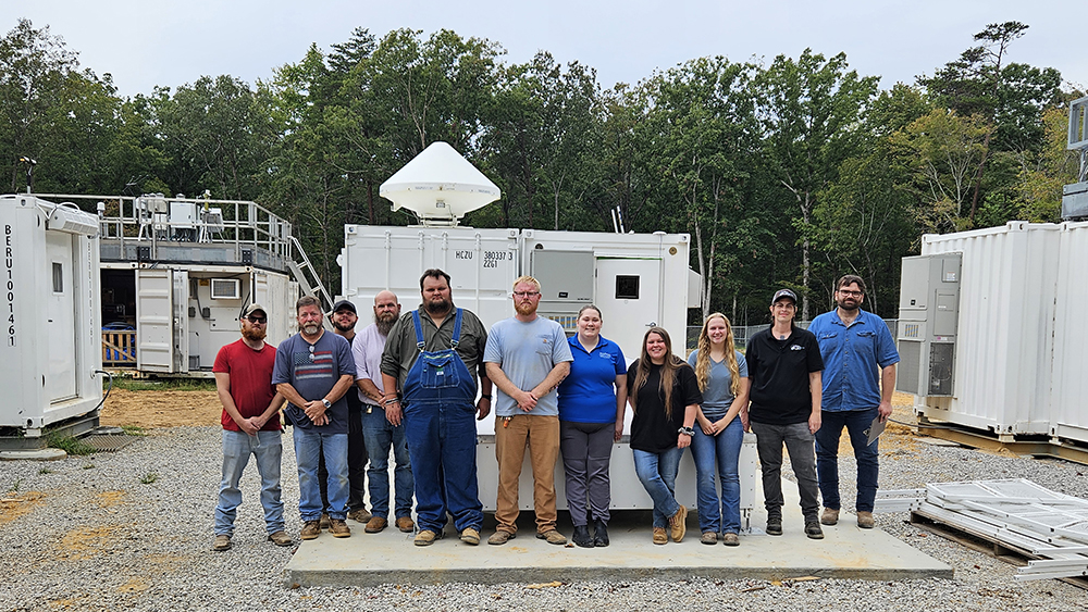
From initial planning through the first year of operations, the establishment and management of the BNF are considered “major accomplishments,” says Spychala. The deployment has faced challenges, including weather, logistical issues, and the complexities of accessing and handling equipment at radar sites. Despite these hurdles, he says, “The team consistently addressed issues with efficiency and professionalism.”
For example, the site operations team worked closely with local landowners, safety management personnel, power utilities, and internet providers to deploy advanced radar systems in isolated locations.
Supplemental Sites Strengthen Observations
Soon after the main BNF site started generating data, ARM launched operations at the three supplemental sites outside the forest. These sites focus on key atmospheric data, including surface fluxes (energy exchanges between the land and atmosphere), atmospheric gases, radiance, aerosol profiles, soil moisture, and weather conditions.
Each of the supplemental sites—located in Courtland, Double Springs, and Falkville—has a collection of advanced instruments to provide spatial context to the observations from the main site.
“The supplemental sites focus on profiling modules, providing observations over a range, while the main site carries a heavier instrumentation load,” says Spychala, highlighting how the sites are helping the research community explore details of air movement and cloud formation. “By linking atmospheric conditions at nearby sites to those observed at (the main site), scientists can draw broader conclusions about atmospheric processes across the region.”
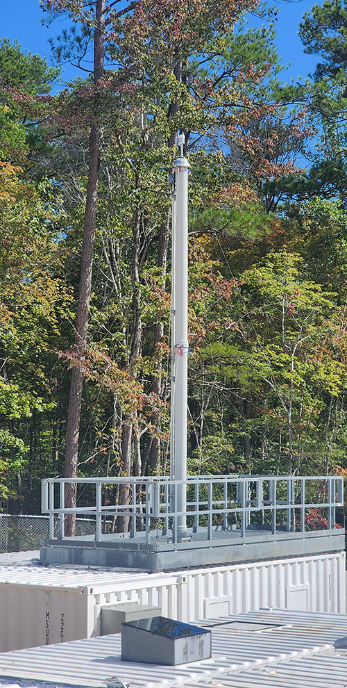
Lidars: Big Picture to Fine Details

ARM users can access a broad range of BNF lidar data to better understand aerosol properties and radiative characteristics, atmospheric thermodynamic state, and wind profiles.
Capabilities at the main site include vertically pointing micropulse and Raman lidar technologies to observe detailed profiles of aerosol, water vapor, temperature, and cloud properties. Ceilometer technology measures cloud base height, vertical visibility, and key atmospheric properties, such as aerosol backscatter.
The main site also has a high-spectral-resolution lidar, an advanced remote sensing instrument that accurately differentiates between aerosols and molecules, provides vertical profiling, and measures aerosol properties without heavily relying on approximations. The lidar’s new 1064-nanometer infrared channel allows for greater detail than ever of aerosol properties throughout the atmospheric column.
Meanwhile, scanning Doppler lidars are deployed at the main site and the Courtland and Double Springs supplemental sites to help researchers learn about wind patterns across the BNF region. The Doppler systems provide measurements of radial velocity and attenuated aerosol backscatter, and they are typically used for wind profiling, turbulence research, and analysis of boundary-layer dynamics.
Metaphorically comparing the scaling ability of various lidar systems to camera lenses, says Spychala, “You need both a landscape lens and a macro lens to capture the big picture and finer details. Our range of lidar instrumentation allows researchers to scale spatially and temporally to bridge gaps in their studies.”
Multifaceted Radar Capabilities

BNF radars complement other ground-based instruments to improve understanding of storm dynamics, weather patterns, atmospheric processes, and more.
Storms like those in the BNF region, characterized by significant convection and heavy rainfall, can greatly affect energy infrastructure through flooding, lightning, and power line damage.
“Radar locations and capabilities are central to the BNF radar strategy,” says Iosif “Andrei” Lindenmaier, ARM’s lead radar mentor at Pacific Northwest National Laboratory in Washington state. He adds that the BNF radar network includes instruments at the main BNF site and two additional locations outside the forest, spaced 9 to 12.5 miles (15 to 20 kilometers) apart. This arrangement supports interactive data collection, enhancing the precision of atmospheric measurements.
At one of the sites outside the forest, a Ka-Band Scanning ARM Cloud Radar and an X-Band Scanning ARM Cloud Radar focus on analyzing cloud microstructures. Another radar site, located farther north, began operations in February 2025. It features the second-generation C-Band Scanning ARM Precipitation Radar (CSAPR2), an advanced weather radar that examines the microphysical properties and life cycle of convective clouds. The CSAPR2 uses dual-polarization technology and adaptive scanning to provide detailed insights into storm development.
Meanwhile, the main BNF site houses a Ka-Band ARM Zenith Radar (KAZR), which started operating in November 2024. The KAZR produces continuous vertical profiles of clouds and precipitation, measuring radar reflectivity, Doppler velocity, and spectral width. Its radial spectral data assist in analyzing precipitation properties.
A radar wind profiler complements the KAZR, enabling tasks such as storm tracking and cloud analysis through synchronized measurements designed to scan areas around the zenith-pointing radar.
Aerosol Systems Deliver Research Impact
A significant milestone in the BNF’s first year was the deployment of the ARM Aerosol Observing System (AOS). This system integrates over a dozen ground-based instruments at the main site to ensure comprehensive data collection and quality control through comparison and closure analysis, providing dependable baseline measurements.
According to ARM AOS lead mentor Olga Mayol-Bracero of Brookhaven National Laboratory (BNL) in New York, the system collects data on aerosol microphysical properties, composition, hygroscopicity (a particle’s ability to take up moisture from the environment), optical properties, and atmospheric gases—all essential for understanding particle sources, transport, fate, and size.
As Mayol-Bracero explains, particle size influences how particles interact with radiation, form clouds, and affect atmospheric processes. Particle size also provides clues about their sources. Fine particles often originate from combustion or secondary formation, while coarse particles can come from dust or sea spray.
Mayol-Bracero says the BNF region is an important area for aerosol observations because of its ecological variety and aerosol interactions. BNF data enable ARM users to study both biogenic (naturally occurring) forest aerosols and particles transported from outside areas, like African dust.
ARM instrument mentors are the backbone of AOS operations. Mayol-Bracero emphasizes their multifaceted roles in maintaining and calibrating instruments, as well as ensuring the accuracy of samples and data. “We have scientists behind each of these instruments, ready to work with individual researchers to help ensure successful analysis,” she says.
Since BNF AOS operations started over a year ago, Mayol-Bracero says the system has had minimal downtime and consistently delivered high-quality data that are providing deeper insights into atmospheric processes for earth system models.
The main site also includes a guest AOS, which provides ARM users with a dedicated space to operate their own aerosol instruments, using the same sampling infrastructure as the core AOS.
Principal investigators interested in using the BNF guest AOS for a small campaign can learn more about the proposal process on ARM’s Campaigns web page. Small campaigns, which can include guest instrument deployments or sample collection at ARM sites, cost ARM less than $300,000. ARM accepts proposals for small campaigns throughout the year.
Value-Added Products: Delivering Context for Measurements

ARM staff were also busy producing value-added products (VAPs) during the BNF’s first year.
VAPs are refined data sets derived from raw measurements or other VAPs. Designed to improve the usefulness of ARM observations, VAPs serve as essential tools for atmospheric research and earth system modeling.
Throughout the year, ARM’s VAP development team expanded its BNF offerings. BNF VAPs announced by ARM during the year included gridded scanning cloud radar products, merged aerosol size distribution data, laser and video disdrometer quantities, airmass trajectories, and best-estimate precipitation data.
To date, data from more than 30 BNF VAPs have been archived in the ARM Data Center.
On ARM’s VAPs page, researchers can using search options such as data source type, measurement category, and primary measurement.
Supporting User Research
“We aim to provide cutting-edge capabilities that researchers can supplement with their own tools and instruments.”
BNF Manager Mark Spychala
Some of the campaigns that began in the BNF’s first year are ongoing. Spychala describes a flexible collaboration model in which researchers can either work onsite with their own equipment or send their instruments to be handled and monitored by the ARM site operations team.
“ARM users come to set up their instrumentation and then train site operations staff to manage and monitor it,” says Spychala. “Ultimately, the ability to scale observations, from spatial to temporal, helps to ensure that they won’t encounter data limitations that could hinder their work. We aim to provide cutting-edge capabilities that researchers can supplement with their own tools and instruments.”
Spychala also notes the collective effort required to bring the observatory’s vision to life, emphasizing the crucial roles played by ARM staff and users. “The BNF has become a hub for atmospheric science—a place where innovation, collaboration, and discovery come together.”
Editor’s note (January 26, 2026): A new paper on the BNF deployment, written by members of the BNF’s site science and operations teams, has been published by the Bulletin of the American Meteorological Society (BAMS). Read the new paper on the BAMS website.
Author: Mike Wasem, Staff Writer, Pacific Northwest National Laboratory
# # #ARM is a DOE Office of Science user facility operated by nine DOE national laboratories.
Follow Us:


Keep up with the Atmospheric Observer
Updates on ARM news, events, and opportunities delivered to your inbox
ARM User Profile
ARM welcomes users from all institutions and nations. A free ARM user account is needed to access ARM data.


